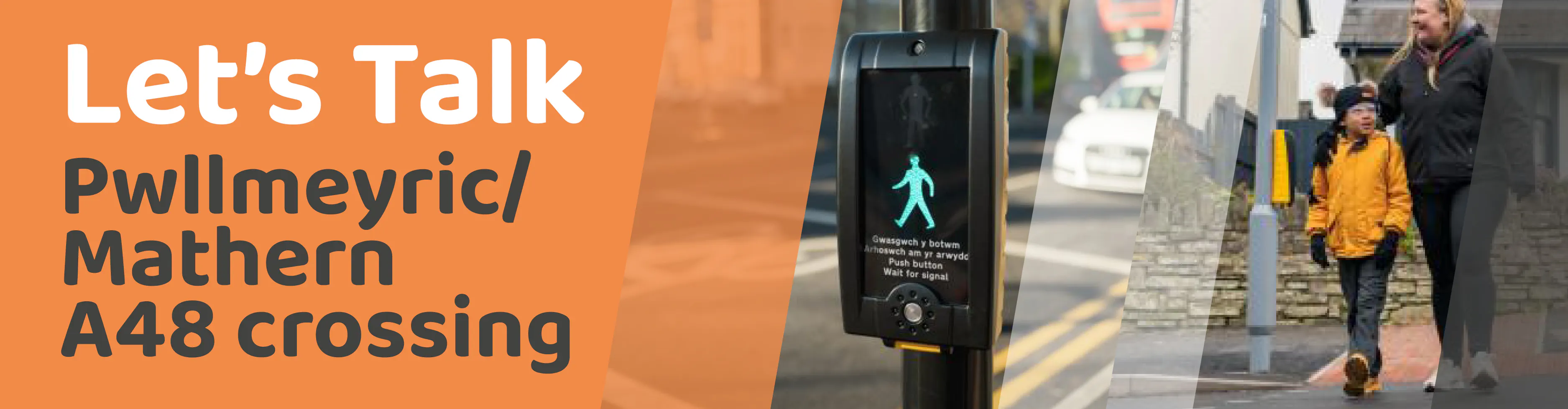
Q&A Pwllmeyric A48 Pedestrian Crossing
- School, work, shops and services in Chepstow
- Bus services (73, 74, X74, T7)
- Around 12,000 vehicles per day travel through this area
- Speeds often exceed the 30-mph limit
- The road includes gradients, bends and driveways which reduce visibility
- Several collisions have occurred here in recent years
- There is no accessible, designated crossing across the A48 in Pwllmeyric
- Pedestrian and cyclist counts – see section 10., below
- Traffic volume and speed surveys – see section 11., below
- Site-based engineering assessments: Road gradients and bends, Sightlines, Footway widths, Side roads and driveways, Bus stops, Space for signal equipment
- It is the closest safe location to more peoples’ walking routes
- It meets or exceeds required visibility distances for vehicles travelling at real monitored speeds
- Vehicles approaching from Chepstow are on a flatter section, improving stopping safety
- Vehicles coming uphill into Pwllmeyric naturally approach more slowly
- It avoids the steep gradient and increased vehicle momentum further west
- Access to driveways is maintained
- The steep gradient increases braking distance and skidding risk
- The crossing would be hard to position without blocking access
- A crossing here would not meet required visibility or safety standards
- Stopping distances are less favourable due to vehicle momentum
- It does not meet the route of people walking from Mathern via Chapel Lane: People are less likely to use the crossing if they need to backtrack
- Some people cross here already, apparently finding it easier to judge gaps in the traffic at this point. This remains the case if a signalised crossing is installed elsewhere to serve other routes.
- Significantly removed from where most people walk
- Near the end of the ‘pedestrian catchment’, where you would find the least number of people walking to ‘trip attractors’ such as work, school, shops and services
- Traffic volumes and speeds exceed the threshold for a zebra crossing
- A signal-controlled crossing makes a mandatory stop for traffic, meaning that drivers must yield to people crossing
- Sensors (for puffin crossings) can support slower pedestrians, including children or older adults
- Little impact on wider Chepstow congestion
- No significant queue build‑up
- Better safety for pedestrians even during peak traffic, when there is a risk otherwise that people will cross between stationary traffic in one lane and live traffic in the other.
- Tactile paving and dropped kerbs
- Rotating tactile cones on the push‑button units - this is now a standard additional signal mechanism for visually impaired people
- Puffin crossings detect pedestrians on the crossing and extend the green man phase if you need longer to cross.
- Audible signal if advised: Assessment of whether audible beeping is appropriate will be made during detailed design. If included, the beeps will sound when the crossing button is pressed, i.e. at times of high vehicle flows.
- Build-outs will be added at the crossing to increase the footway width as shown in the drawing. This design allows people to be more visible when you stand to cross, with better accommodation for people waiting. The roadway will be narrowed at the crossing by the buildout, making the road width at the crossing 6.4 metres kerb-to-kerb (3.2m lane widths). This meets current Highways Standards to ensure modern vehicles are accommodated when passing.
- The Bayfield Road/Mounton House Road junction and side-road crossing will be updated as shown in the drawing. The junction kerbs will be extended to accommodate dropped kerbs and tactile paving. Currently, the footway tapers out by the bus stop. The adjustment will mean that people crossing do not need to walk so far in the carriageway and you are better able separate the sound of the side-road from the main road traffic, and that there is more space to stand outside the walled-in bus stop if waiting for the bus. Access to driveways will be maintained.
- High friction surfacing will be applied to reduce braking distances even in wet conditions. The surfacing and zig-zag lining will be applied to the A48 as shown in the drawing, as part of the crossing installation.
- The crossing signal heads (i.e. traffic lights), bollards and lining will be a visible sign to drivers that you are approaching a crossing
- Average Daily Traffic volume: 13,188 vehicles per day
- 8.1% of those were goods vehicles
- Eastbound: Average speed: 29.8 mph, 85th%ile speed 34.5 mph
- Westbound: Average speed: 30.5 mph, 85th%ile speed 35.4 mph
- Average Daily Traffic volume: 11,794 vehicles per day
- 8.8% of those were goods vehicles
- Eastbound: Average speed: 30.4 mph, 85th%ile speed 34.4 mph
- Westbound: Average speed: 30.4 mph, 85th%ile speed 34.5 mph
- Lower cost and simple operation
- Drivers must yield without a signal when people want to cross
- Not suitable here because the A48 carries higher traffic volumes than recommended for a zebra crossing
- Push‑button operated. Displays the standard red/green man at signal-head height
- Includes a flashing amber phase in every cycle
- Push‑button operated. Displays the standard red/green man at push-button panel height
- Uses sensors to detect whether someone needs longer when crossing, extends crossing time/red light for drivers if needed– this is a responsive replacement for the flashing amber phase
- Higher installation costs
1. Why is a crossing needed in Pwllmeyric?
People living in Mathern and Pwllmeyric need to cross the A48 to reach:
Between Pwllmeyric and Chepstow, the footway is on the north side of the A48. This means people walking from the south side must cross the road. This includes anyone who lives south of the A48 in Pwllmeyric and Mathern. Current conditions make crossing difficult because:
The proposed crossing aims to make walking a safer and more realistic option for everyday trips.
2. What studies were carried out to prepare this proposal?
To ensure the proposal is safe and justified, the following assessments were completed:
These helped rule out unsafe locations and identify where a crossing could be safely accommodated.
3. Why is the proposed crossing location on the eastern side of Pwllmeyric?
The recommended crossing location is on the A48 at the east end of Pwllmeyric, just west of the Bayfield Road/ Mounton House Road, as shown in the consultation diagram.
This location was chosen because:
4. Why were some potential crossing locations rejected?
Mid‑block (between the eastern and western ends of Pwllmeyric)
Site rejected because:
South of Chapel Lane (towards Badgers Meadow)
Site rejected because:
West end of A48 Pwllmeyric, adjacent to Mounton Brook
Site rejected because:
5. Why is a signal-controlled crossing (Puffin) recommended?
Based on all surveys, site assessments and safety considerations, the design team recommended a Pelican or Puffin signal-controlled pedestrian crossing positioned on the eastern side of Pwllmeyric. See section 11., below, for a summary of the crossing design options. A Puffin crossing is proposed due to its responsive sensor technology. This responsiveness improves accessibility for people walking and wheeling, while mitigating unnecessary delays to vehicle traffic.
6. Will the crossing cause congestion?
The proposed crossing is on a stretch of road with mainly through-traffic. Traffic congestion at the High Beech roundabout, Wye Valley Link Road and Chepstow more widely is recognised and is known to impact on Pwllmeyric. The proposed crossing in Pwllmeyric is at a remove from High Beech. Engineers expect:
7. Will the crossing be accessible to disabled people?
Yes. Currently, there is no accessible way to cross the A48 in Pwllmeyric, meaning at-will crossing is more difficult if you have accessibility needs. This Puffin crossing will make crossing the road more accessible. The accessibility of the Bayfield Road/Mounton House turning side-road crossing will also be improved as part of the crossing installation. The crossing will include:
8. How will the road and pavements be changed?
The drawing shows that there will be several changes to the surrounding road and pavement as elements of the crossing installation.
9. Count of people crossing the A48 in Pwllmeyric
Pedestrian data on A48 Pwllmeyric was obtained via video capture, from cameras installed at two count stations. The cameras captured 7 days of pedestrian movement between 7am and 7pm daily between Wednesday 5 November and Tuesday 11 November 2025 (school term-time). The weather was mild with isolated periods of light rain.
From both sites obtained data, it was noted that pedestrians appeared sporadically with no distinct timing to the patterns of movement. Most people counted were adults, with only four noted as children.
Count of people crossing …:
Count station 1 (East) – Average 22 per day
Count station 2 (West) - Average 19 per day
The number of people cycling past was also counted. An average of 11 cycles passed the east count station daily, and an average of 8 cycles passed the west count station daily.
Count station 1 (East) Count station 2 (West)

10. Count of vehicles on the A48
A week-long speed and vehicle class survey was completed for the purpose of this project. The current traffic volume and speed within the village suggests that a crossing is needed to support walked trips in Pwllmeyric.
Count station 1 Pwllmeyric East
Count station 2 Pwllmeyric West
Following the study of pedestrian and vehicle numbers, the crossing has been positioned to meet guidance on sightlines and stopping distances, based on known traffic speeds and the site’s topography. At the recommended site at the east end of Pwllmeyric, the desirable visibility splay distances were seen to exceed the 85%ile speed - as in, visibility distance at the recommended site for the crossing was more than enough given the actual road speeds as recorded above.
11. What types of crossing were considered?
Three crossing types were reviewed:
Zebra crossing
Pelican crossing
Puffin crossing
If you have any further questions regarding the proposals, please contact ActiveTravel@monmouthshire.gov.uk